A mature, scenic, family-oriented neighbourhood on the southwest side of West Kelowna, the southernmost of the city's seven neighbourhoods.
Glenrosa is one of the neighbourhoods the City of West Kelowna points to as having roots dating back to the early-to-mid 19th century. That history sits alongside the modern city: West Kelowna itself only incorporated in 2007 (first as the Westside District Municipality, renamed West Kelowna in 2009, and recognized as a city in 2015), so Glenrosa's residential streets predate the municipality that now governs them by generations.
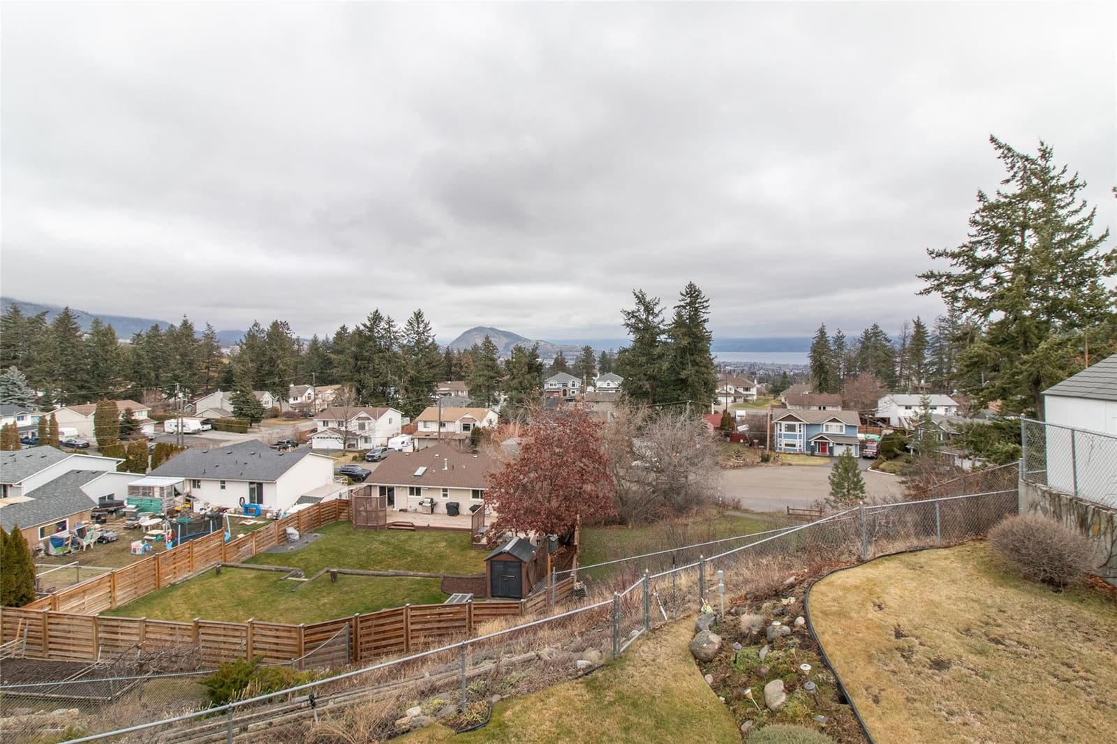
Built on the gently sloping hillsides above Highway 97 and Powers Creek, Glenrosa's streets extend up Glenrosa Road into the mountain foothills. It mixes established 1970s-80s split-level family homes on large, mature lots with newer infill, including modern farmhouse and craftsman-style single-family builds. Historically, it's offered some of the best value for space in West Kelowna, making it a staple for young families and first-time buyers wanting a backyard and a driveway.
West Kelowna's seven neighbourhoods really split east-west, not north-south: Lakeview Heights sits alone on the east side of Highway 97, on the benches above the lake, while the other six sit west of the highway. Glenrosa is the southernmost of those six, reached, along with neighbouring Smith Creek, via Westbank Centre's central corridor.
Powers Creek runs along Glenrosa's eastern border, cutting through a canyon of hiking trails and small waterfalls. Trepanier Provincial Park and Crown land border the neighbourhood to the west and north, offering direct access to wilderness, ridge walking, and pine forest.
It's a quick drive down to Highway 97 (under 5 minutes) and to Westbank Centre's grocery stores, banks, and dining, but the trip across the William R. Bennett Bridge into downtown Kelowna takes 20-25 minutes depending on traffic. Because Glenrosa gains real elevation climbing up Glenrosa Road, it sees more snow than the lower lakeside neighbourhoods, so good winter tires matter here.
A genuinely family-oriented corner of West Kelowna.
Schools (Central Okanagan Public Schools, District #23)
K–5, on Webber Road, with English and French Immersion streams.
K–5, on the south side of Glenrosa.
Grades 6–8, centrally located with extensive athletic fields.
Grades 9–12, down on Cameron Road elsewhere in West Kelowna. Students commute via school bus or transit, not on foot.
Parks & Recreation
Playgrounds, sports fields, and tennis/pickleball courts throughout the neighbourhood.
Runs along the eastern border, with canyon hiking trails, small waterfalls, and forested walking loops.
Perched in upper Glenrosa, solar-powered, with a goat-grazed living roof and lake views.
Mountains & Outdoor Access
At the top of Glenrosa Road, with 50+ km of groomed cross-country ski and snowshoe trails, dog-friendly.
Minutes further up the mountain road, with mountain biking, off-roading, and backcountry snowmobiling.
Goat's Peak is West Kelowna's newest master-planned hillside community, on the southern edge of the city along Highway 97 heading toward Peachland. Built on steep, terraced slopes, homes here (including newer master-planned communities like Shorerise) are designed around maximizing panoramic south-facing views over Okanagan Lake. The result is upscale, modern, and rapidly growing.
No schools inside Goat's Peak itself. Students commute a short distance to Helen Gorman or George Pringle Elementary, Glenrosa Middle, and Mount Boucherie Secondary.
Bordered by Goat's Peak Regional Park, a 52-hectare protected conservation area with hiking trails and hilltop lookouts, just above the Gellatly Bay waterfront promenades and Gellatly Nut Farm Regional Park.
Sits directly on the slopes of Goat's Peak, with high-elevation views and quick access to backcountry trails leading south into Peachland and Crown wilderness.
Note: on MLS boundary mapping, this fringe pocket can fall under either Glenrosa or Westbank Centre depending on the exact street.
Updated daily, straight from MLS®.
École Glenrosa Elementary and Helen Gorman Elementary (both K–5), Glenrosa Middle (6–8), and Mount Boucherie Secondary (9–12) for high school, though Mount Boucherie Secondary is down on Cameron Road elsewhere in the city, so high schoolers commute by bus or transit rather than walking.
It's the southernmost of West Kelowna's seven neighbourhoods, west of Highway 97, not actually near Mount Boucherie itself, though it does have panoramic views of the mountain and Okanagan Lake from its hillside streets.
Old by Okanagan standards. The City of West Kelowna identifies it as one of several neighbourhoods with roots dating to the early-to-mid 19th century, well before the municipality itself was incorporated in 2007.
Get a straight read from a team that tracks this neighbourhood closely.